geo409-field-trip-maps
2 maps to use on a field exercise
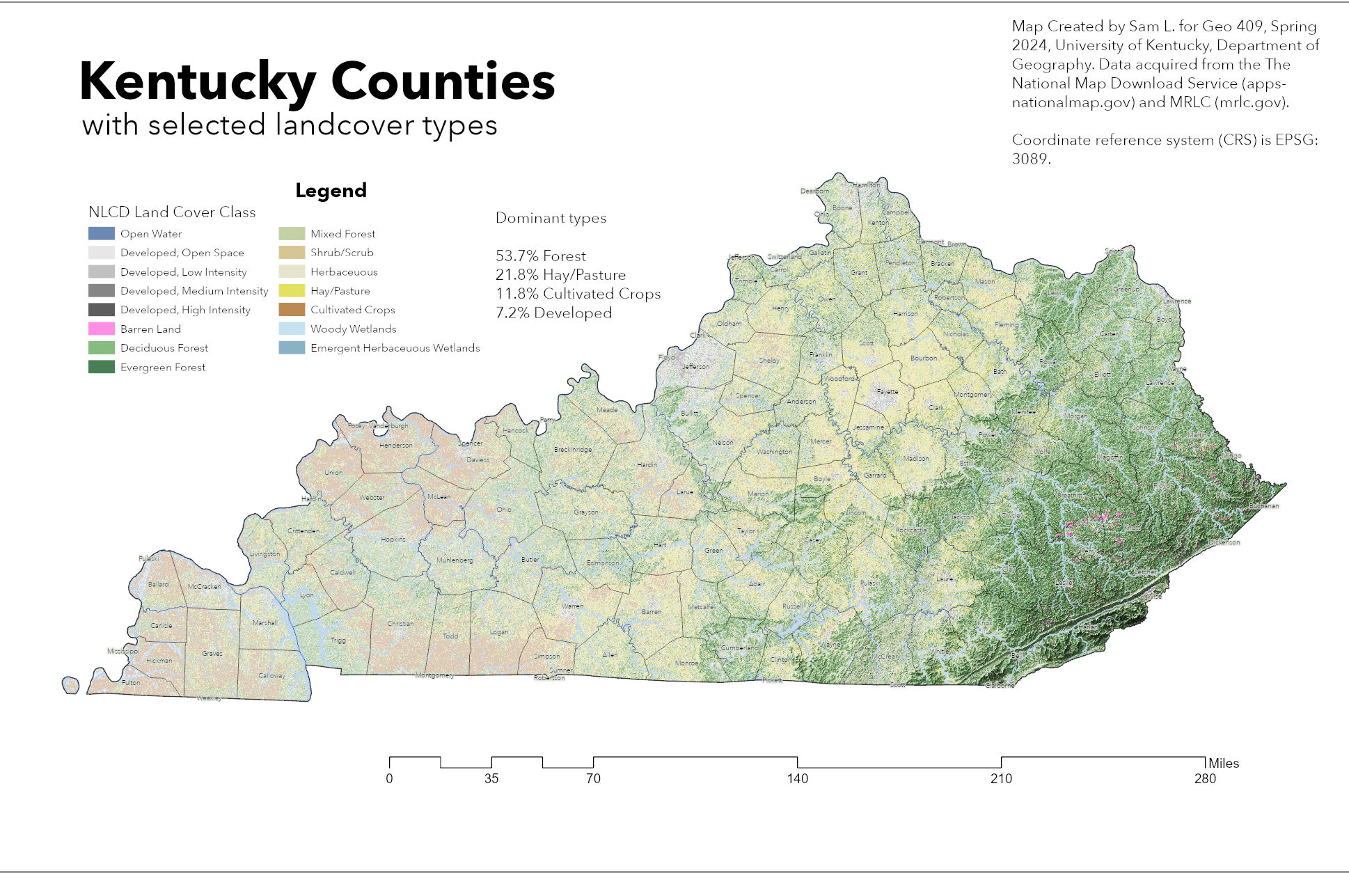 Kentucky counties with selected land cover types- Download GeoPDF
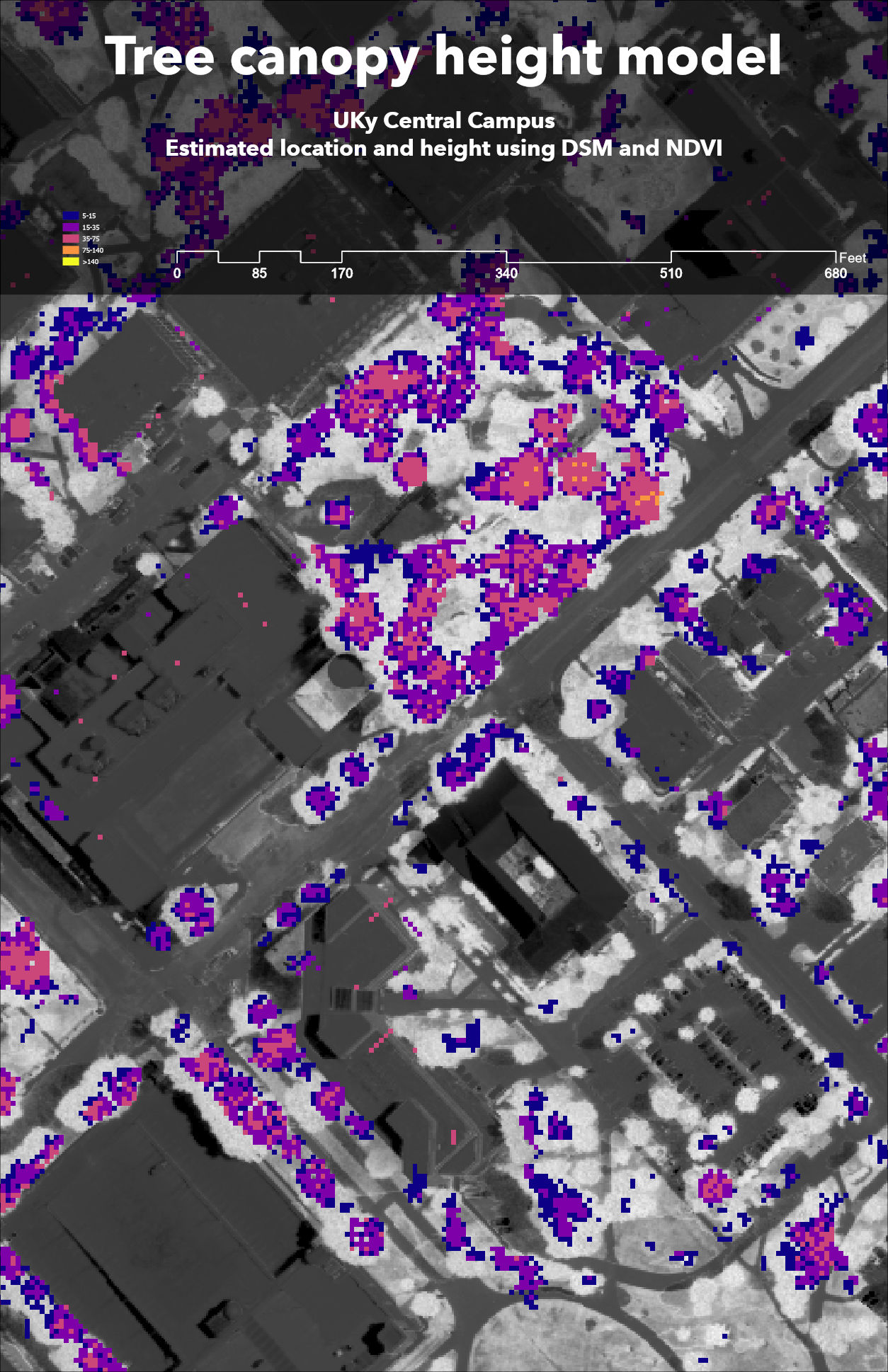
UKy central campus canopy model- Download GeoPDF
Maps created by Sam L. for GEO409, Spring 2024, University of Kentucky Department of Geography
https://sgla226.github.io/geo409-field-trip-maps/